Autodesk Technologist with Information about Stormwater Management Model (SWMM) for watershed water quality, hydrology and hydraulics modelers (Note this blog is not associated with the EPA). You will find Blog Posts on the Subjects of SWMM5, ICM SWMM, ICM InfoWorks, InfoSWMM and InfoSewer.
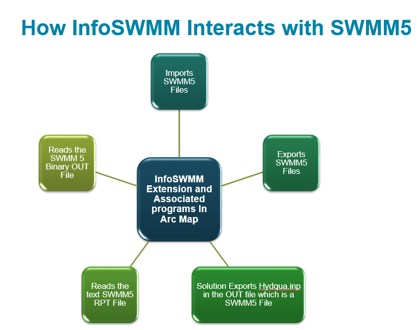
How #INNOVYZE InfoSWMM or #INFOSWMM Interacts with #SWMM5
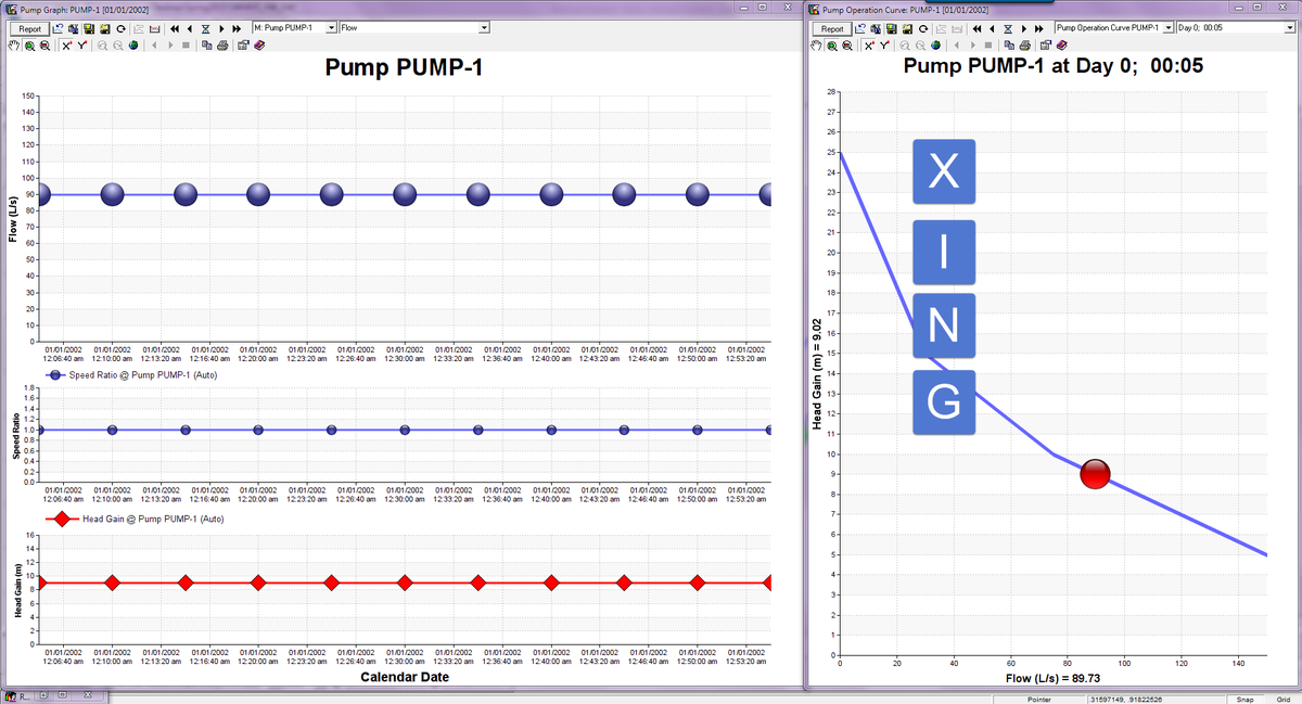
The Customizable Graphics in #INFOSWMM and #H20MAPSWMM aid in understanding complex Simulate the Hydrology, Hydraulics & WQ of Combined, Stormwater and Sanitary NW using #INFOWORKS_ICM & #INFOSWMM
modeling networks via Panels
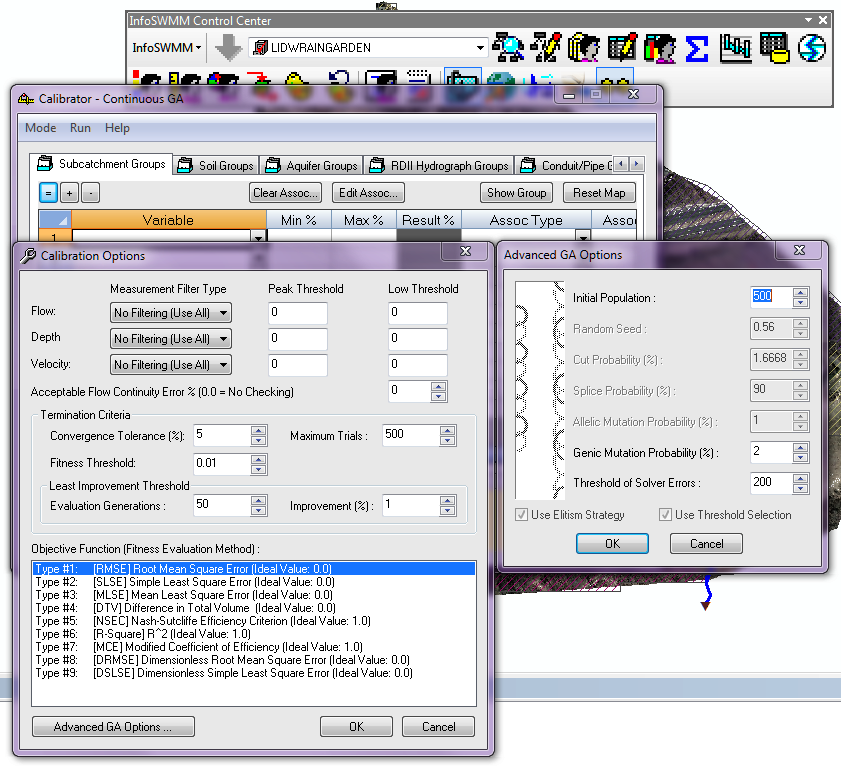
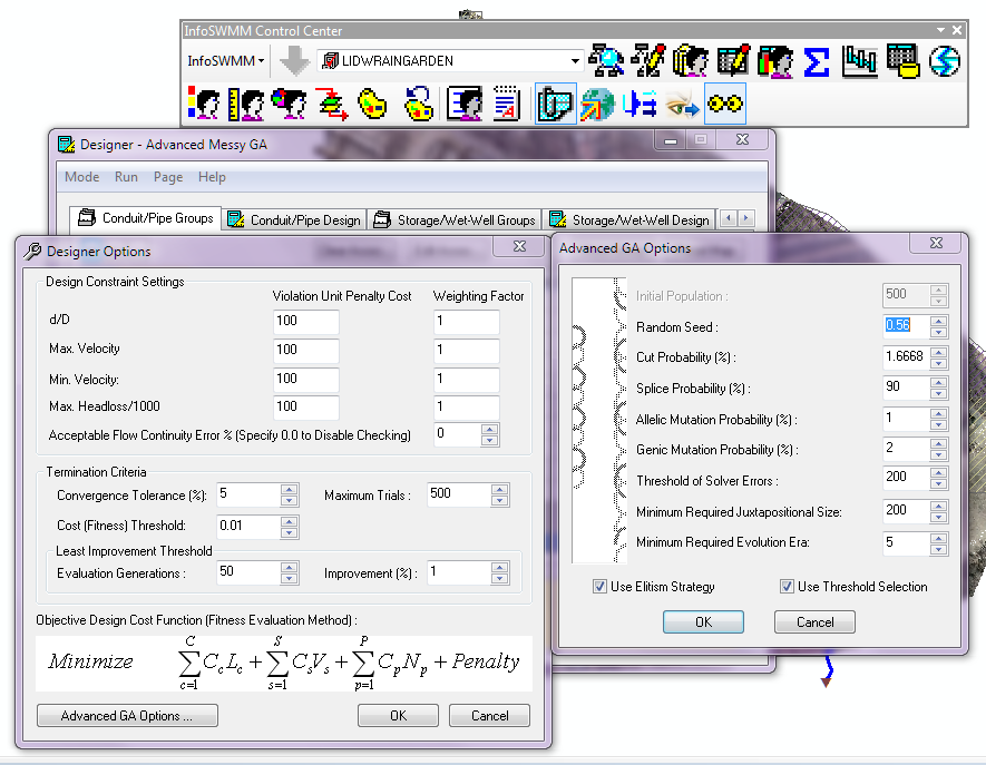
#INFOSWMM Genetic Algorithm Suite Programs Calibrator and Designer w/ #GA Options
No comments:
Post a Comment