Innovyze InfoSewer vs InfoSWMM and H2OMap SWMM vs H2OMap Sewer
A short comparison of the features in infoSWMM and infoSewer. Many of the same rows apply to H2OMap SWMM and H2OMap Sewer.
| Feature Class | Feature | InfoSewer | InfoSWMM |
| Base Functionality | Conservative Solution as an option | ||
| Public domain engine | |||
| Calibrate model to flow data | |||
| Calibration Data | |||
| Models siphons | |||
| Infers missing inverts | |||
| Validation tools | |||
| DWF Allocator | |||
| Models flow attenuation | |||
| RDII flow data processing | |||
| Facility Manager | |||
| Batch Simulation | |||
| Scenario Manager | |||
| Scenario Management: Parent-Child Inheritance Functionality | |||
| Advanced Reporting (reserve capacity, freeboard, etc) | |||
| Data Flagging | |||
| Unlimited undo and redo | |||
| Version Control: View Commit History, Compare Differences, and Automate Conflict Resolution | |||
| IT/Database Architecture | Multi-User Architecture: (Runs Standalone, in a Workgroup, or as an Enterprise System) | ||
| 64 Bit Application & Multi Core Processing | |||
| Remote Simulation Capability: (Allows user to continue working on model while sim is occuring) | |||
| Flexible Licensing: Mix-n-match Model Build and Sim Engine seats as required | |||
| 2D/Advanced Hydraulic Modeling | River, Bridge, and Ancillary Modeling | ||
| 2D Included | Add On | ||
| True Representation of Open Channels: 1) No limit to x-sections. 2) Full hydraulic interaction with 2D zones along length of channel and over both river banks. | HEC-RAS | ||
| Superior interaction between rivers, collection systems, and 2D meshes | |||
| GPU Card for Increased Sim time and Stability | |||
| Shock Capturing (models high velocity flows/steep embankments) |
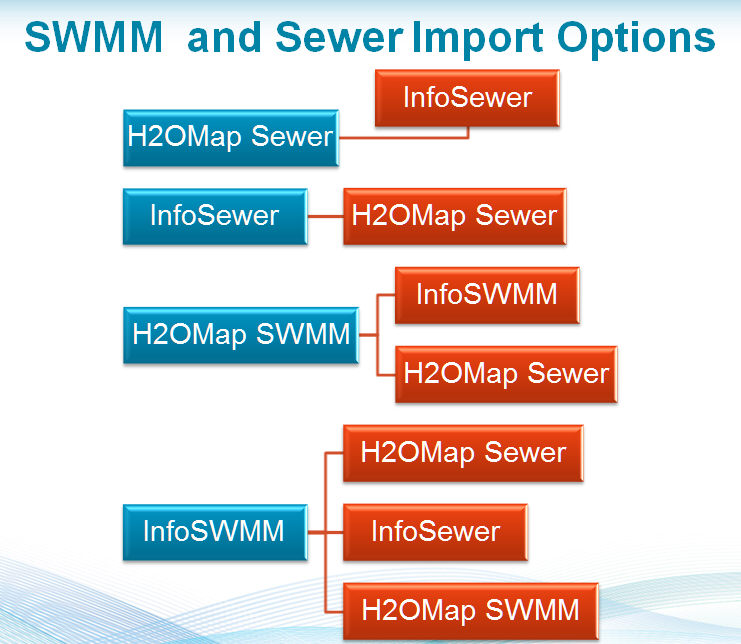
H2OMap SWMM imports H2OMap Sewer and infoSWMM directly
InfoSWMM imports H2OMap SWMM, H2OMap Sewer and InfoSewer directly as shown in the SWMM and Sewer Import Options figure.
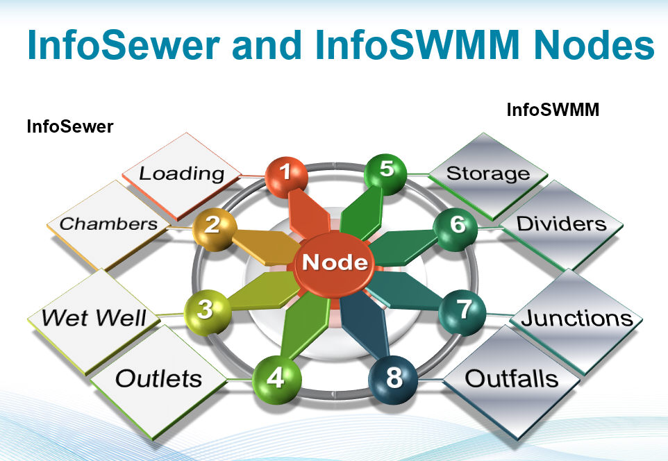
A visual comparison between Sewer and SWMM Nodes