- A Big Map of how
#InfoSWMM looks on Arc Map and works inside of the#Innovyze GUI Tools for#ARCGIS#SWMM5 pic.twitter.com/67M9WxgDGN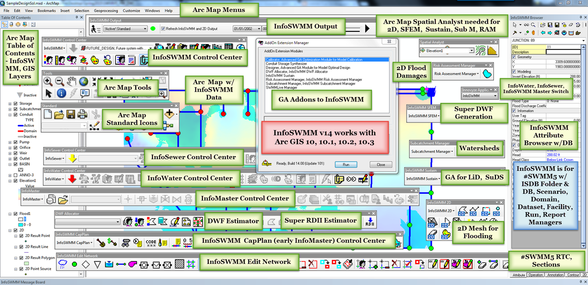
- A Big Map of how
#InfoSWMM Graphs in Arc Map and works inside of the#Innovyze GUI Tools for#ARCGIS#SWMM5 pic.twitter.com/e6BbJstbdj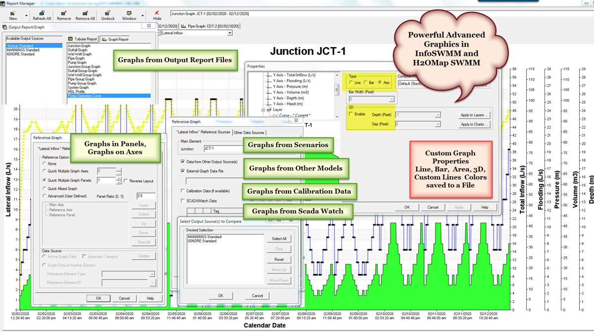
- A Map of when KEEP vs IGNORE options are used in
#InfoSWMM#SWMM5 for the Link St Venant Equation pic.twitter.com/W0L38GYHJV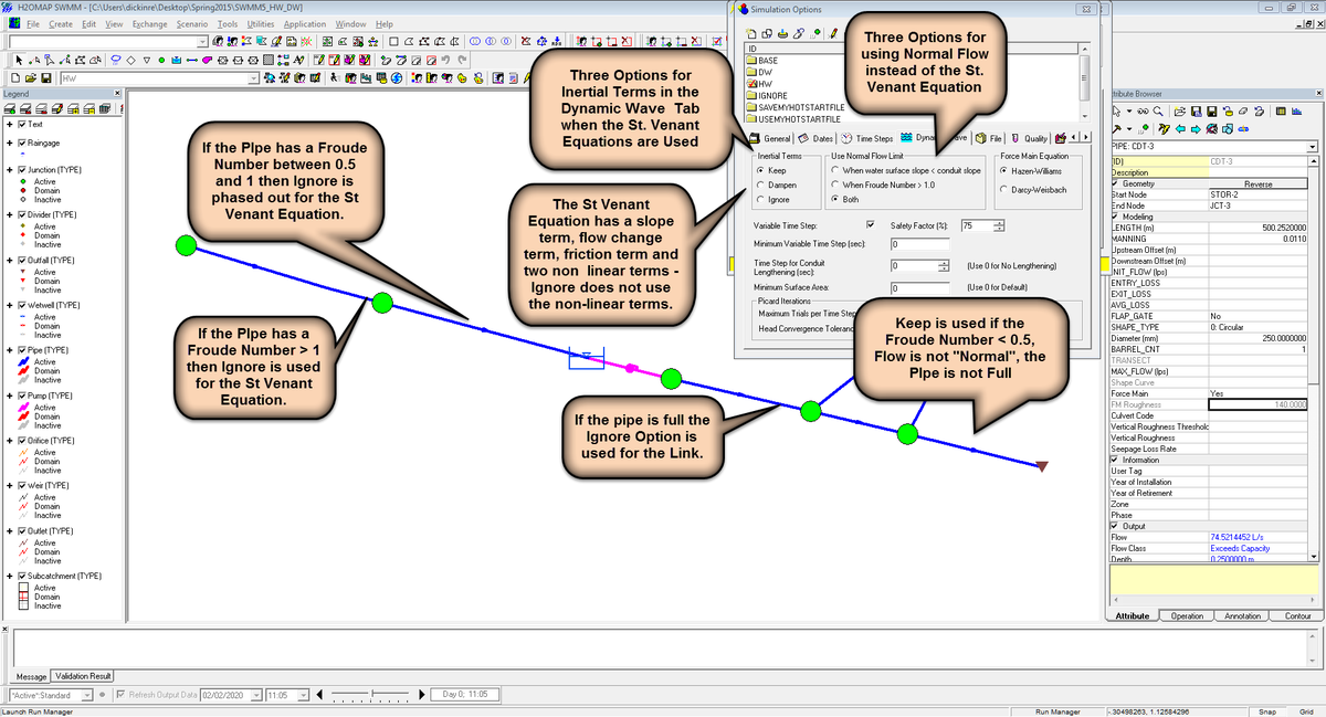
Tuesday, January 19, 2016
Visual Maps of #INFOSWMM for #SWMM5 using Arc Map or Arc GIS
Subscribe to:
Post Comments (Atom)
No comments:
Post a Comment