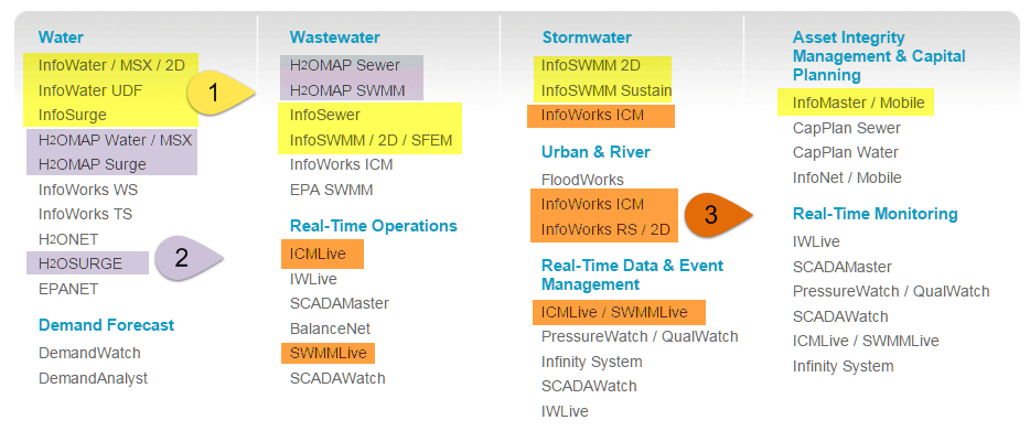
- 1 #INFOSWMM use #ArcGIS , 2 #H2OMAP_SWMM uses #MapInfo, 3 #INFOWORKS_ICM, #SWWMMLive Uses Custom A GUI @Innovyze
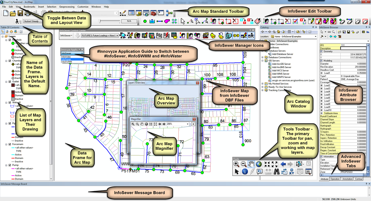
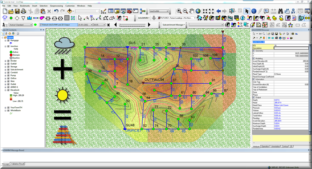
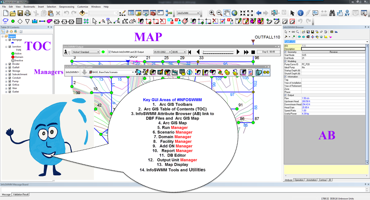
- How #INFOSEWER Maps its DB into #ARCGIS - A Similar Look in #INFOSWMM #iNFOWATER #INFOSURGE and #INFOMASTER
- Continuous Simulation! 1. Precipitation+ 2. Dry+ 3. Hydrology/Hydraulics = 4. #INFOSWMM #INFOWORKS_ICM #rt
- Tweet #1999 from @InnovyzeRobert Many Thanks To All at #INNOVYZE #MONROVIA for PSL Help for #INFOSWMM
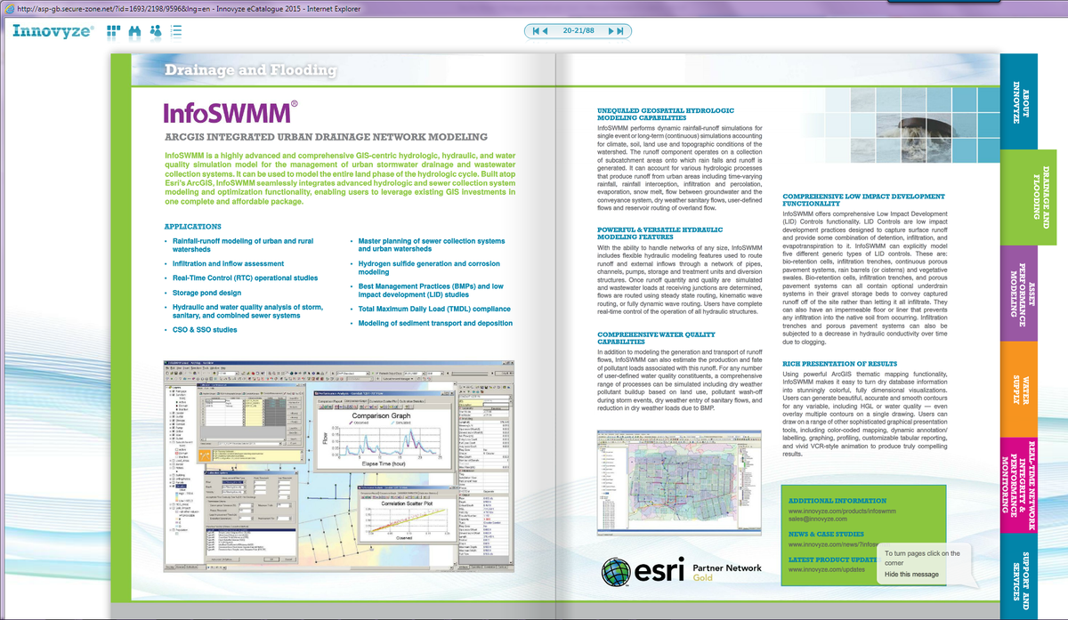
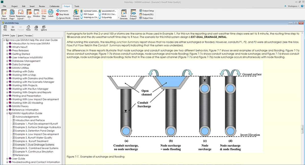
- Great feature of the #INFOSWMM and #H2OMapSWMM Help Files is a detailed Applicaation Guide h/t #EPA for H&HwWQ
- We welcome @LimnoTech in DC as our newest @Innovyze #InfoSWMM client...looking forward to helping in their upcoming modeling projects.
Sunday, January 10, 2016
2016 #INFOSWMM Tweets about #HYDROLOGY #CSO #SWMM5
 Robert Dickinson
 Peter Martin
Subscribe to:
Post Comments (Atom)
No comments:
Post a Comment